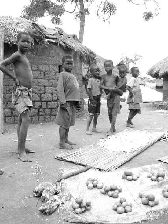
Figure 1.--Today boys even in most rural villages mostly wear Western-style clothing. This photograph was tken in 19??. There are, however, still some more traditiinal tribes. |

|
uganda is a small East African country with a capital and rail hub at Kampala. It is a largely agricultural country, based on a fertile plain where cotton, coffee, and several other crops are grown. There is also some mining. The population is primarily Bantu. Arabs traders dominated the area inthe 19th century. The region was unknown to Europeans until the late 19th century when explorers arrived: John Speke (1862) and Heney Stanley (1875). Britain established a protectorate (1894)
and later annexed adjacent territory. Uganda became independent with Sir Edward Mutessa II who was king of the Buganda Tribe (1962) Prime-minister Obote removed Mutessa and declared Uganda a "unitary" state (1966). Iddi Amin staged a military coupand waged a virtual reign of terror. One of Amin's actions was to expell the Indians (South Asians) which dominated the financial and merchant sector. This was a popular measure, but had a devestating impact on the Ugandan economy. Modern Uganda is engaged in a guerilla war with the nilhisic Lords Resistance Movement.
Uganda is a small African country located between Central and East Africa. It is generally classified as a part of East Africa because it is much closer gto the Indian Ocean than the Atlantic and rail conectiins lead to Induan Ocean ports. The tropical climate is located on the edge of the Equator, but the climate is moderated by the elevation. Uganda averages about 1,100 metres (3,609 ft) above sea level. The country is bordered by the Democratic Republic of the Congo (DRC), Kenya, Rwanda, Southern Sudan, and Tanzania. Much of its western and southern borders is lakeshore. Uganda is landlocked with no access to the sea, but has rail links through Kenya to Mobassa, an Indian Ocean port. The capital, Kampala, is a major rail hub. The terraine is mostly plateau with some rolling hills and low mountains. Grassland and tropical forest dominate the central region, with volcanic foothills in the east. The Ruwenzori Mountains form much of the southwestern land border with the DRC. The highest peaks there are snow capped. In eastern Uganda, the border with Kenya is marked by volcanic hills. Uganda is generally well watered. Northern areas of the country are affected by desertification and the expanding Sahara, especially the northeast (the Karamoja). To the south are both interior and border lakes. About 20 percent of the total area is open water or swampland. Four of East Africa's Great Lakes and the source of the Nile (Lake Victoria, Lake Kyoga, Lake Albert, and Lake Edward) are within Uganda or on its borders. Lake Victoria is vast, the second largest inland freshwater lake in the world (after Lake Superior) and it feeds the upper waters of the Nile River. The outflow from the Lake is the Victoria Nile. Lake Kyoga and the basin where vit is located dominate central Uganda. Smaller lakes of note incluse: Lake Kwania, Lake Bugondo, Lake George and Lake Opeta. Important fisheries are conducted in these lakes.
Uganda is located in the Great Rift Valley where ancient hominids have been found. The countries of the Rift thus have humanities longest known history. Most of it, however, is pre-history. Thus we have to anthropologists and archeologists for the early history of Uganda which literally goes back millions of years. The earliest people popultion we have any infomation on is the Bantu peoples who were engaged in agriculture (about 1000 BC). Sub-Saharan Africa had no written language until contact with the Arabs and Europeans. Iron working technology has been noted (around 1000 AD). Important social and political developments began with the appearances of chiefdomnates or small kingdomses in the fertile south and west. This included the Ankole, Buganda, Bunyoro, Busoga, and Toro kingdoms (17th and 18th centuries). Trade links were formed with Arab Sudan. Slaves were the major commodity which dominated the regional economy at the time. The Uganda chieftanates formed alliances which shifted over time. Eventually the Buganda Kingdom allied to the powerful Shirazis of Zanzibar, became the dominant power in what is now Uganda. Bugada gave Uganda its name. Zanzibar was the center of the East African/Inian Ocean slave trade. Buganda was ruled by Kabaka (traditional kings). They wre not absolute leaders. There authority was limited by a council of nobles. Buganda devloped a standing army and an important agriculture base. As a result, when Britain began its campaign against the Indian Ocean slave trade, Buganda was had thus not devestated economically. Arabs traders dominated the area in the 19th century. The region was unknown to Europeans until the late-19th century when explorers arrived: John Speke (1862) and Heney Stanley (1875). Britain established a protectorate (1894) and later annexed adjacent territory. Uganda became independent with Sir Edward Mutessa II who was king of the Buganda Tribe (1962) Prime-minister Obote removed Mutessa and declared Uganda a "unitary" state (1966). Iddi Amin staged a military coup and waged a virtual reign of terror. This had adevestating impact on the Ugandan econonomy as did his expulsion of the country's South Asians. The country, especially the economy, has never fully recovered. Modern Uganda is engaged in a guerilla war with the nilhisic Lords Resistance Movement.
Uganda is a largely agricultural country, based on a fertile plain where cotton, coffee, and several other crops are grown. There is also some mining. One of Amin's actions was to expell the Indians (South Asians) which dominated the financial and merchant sector. This was a popular measure, but had a devestating impact on the Ugandan economy.
Uganda is populated by many different ethnic groups. There is a basic split between two linguistic groups, the Nilotic North and the Bantu South. Bantu speakers are the largest single segment of the population. The Ganda are the major Bantu group, comprising as much as 20 percent of the overall population. Other important Bantu groups are the Soga, Gwere, Gisu, Nyole, Samia, Toro, Nyoro, Kiga, Nyankole, Amba, and Konjo. A substantial numbers of Rawanans sought refuge in Uganda (late-1960s and early 70s) and remained in the country for 2-3 decades, finally returning to Rawanda (mid-1990s).
Many tribes in the north speak Nilotic languages are represented by Acholi (Acoli), Alur, Kakwa, Karimojong, Kumam, Lango (Langi), Padhola, Sebei, and Teso constitute about 10 percent of the popultion. Central Sudanic peoples also live in the north, including the Lendu, Lugbara, and Madi which comprise a little less than 10 percent of the population.
The British during the colonial period were primarily concerned with the south. As a result, the economy, infrastructure, and educational facilities were primarily developed there. The Bantu people in the suth, as a result, dominated the economy, education, and government of independent Ugnda. The British, however, recruited the security forces from the north.
This inbalance between the economy and secruity forces reinforced by the ethnic/tribal differences has caused great problems.
Uganda is generally divided into four regions (Central, Western, Eastern, and Northern). Each regioned is diivided into districts. There were 56 districts (2002), which wer expanded into 111 districts in addition to Kampala (by 2010). Under British colonial rule, the regions were functional administrative units and referred to as provinces, headed by a Provincial Commissioner. Since independence, the national government deals directly with the districts. The regions no longer have an administrrative function. The four regions have roughly similar populations, but because of differing areas, population densities vary. The Northern region has by far the largest area, but the smallest popultion. Thus it has the lowest population density. It is less well watered than the other regions and thus agricultural productivty is more limited. The northeastern area of Karamoja is Uganda's poorest area. The Lord's Resistrance Army has disrupted Karamoja. Other areas of the north have been affected by the civil war in South Sudan. The Central region is the country's most populace, but by a small margin. It is the historic kingdom of Buganda which had a semi-autonomous government headed by the Kabaka (king). The colonia equivalent of the Provincial Commissioner for Buganda was referred to as the Resident. Buganda was the most importat of the ancient African monarchies that are constitutionally recognised in Uganda. Kampala, the capital and largest cuty, is located in the Central region. As a result, over half of the country's urban popultiin is located in the Cebtral region. The Eastern region is the smallest in area, but has a population close to entral region. The Western region borders the DRC anbd has been affected by the interminable disordes there.
We do not yet have much information on the activties in which Ugandan children participate. We have a little information on Ugandan schools.
Uganda has a comolex relgious structure. There are three primary religious traditions. The indigenous religious tradition is primitive and not organized animism. The British brought Christianity to Uganda in the 19th century as aresult of a very active missionary movement. As a result, about 80 percent of the population is Christian. The south is primarily Christian. Because the increasing religious toleratin in Victorian Britain, the Ugndan Christians are divivided into many different sects. The major denominations are Roman Catholics and Protestants (primarily Anglicans). Other Christian sects are also represented, including Seventh-day Adventists, Baptists, Greek Orthodoxy, Jehovahs Witnesses, Latter-day Saints (Mormons), and Presbyterians. About 10 percent of the population is Muslim which is especially prominant in the north. A string penecostal movement during the 1930s has left an enduring mark on Ugandan Christianity. The differences between some of the Chistian denominations are surprisingly sharp. Islam is particularly promiant in the north. About 10 percent of the population is Muslim. In addition to the main stream religions, charismatic leades have created syncretic creeds freely mixing indigenous animist taditions with most Christian and Islamic beliefs.
There is a small Abayudaya Jewish community in eastern Uganda. They are not etnically part of the Jewish diapora, but converts from the early 20th century.
Arab traders were active in East Africa in the 19th century. I am not sure to what extent this affected clothing trends in the area. The Britih colonized Uganda at the end of the 19th century. Western clothing before World War II was largely restricted to Kampala Today boys throughout Uganda primarily wear Western-style clothing. Traditional clothing is today rarely seen.

Navigate the Boys' Historical Clothing Web Site:
[Introduction]
[Activities]
[Biographies]
[Chronology]
[Cloth and textiles]
[Clothing styles]
[Countries]
[Topics]
[Bibliographies]
[Contributions]
[FAQs]
[Glossaries]
[Images]
[Links]
[Registration]
[Tools]
[Boys' Clothing Home]
Navigate the Boys' Historical Clothing national pages:
[Return to the Main African page]
[Algeria]
[Australia]
[Belgium]
[England]
[France]
[Germany]
[Ireland]
[Italy]
[Japan]
[Korea]
[Mexico]
[New Zealand]
[Scotland]
[]
[United States]