
|
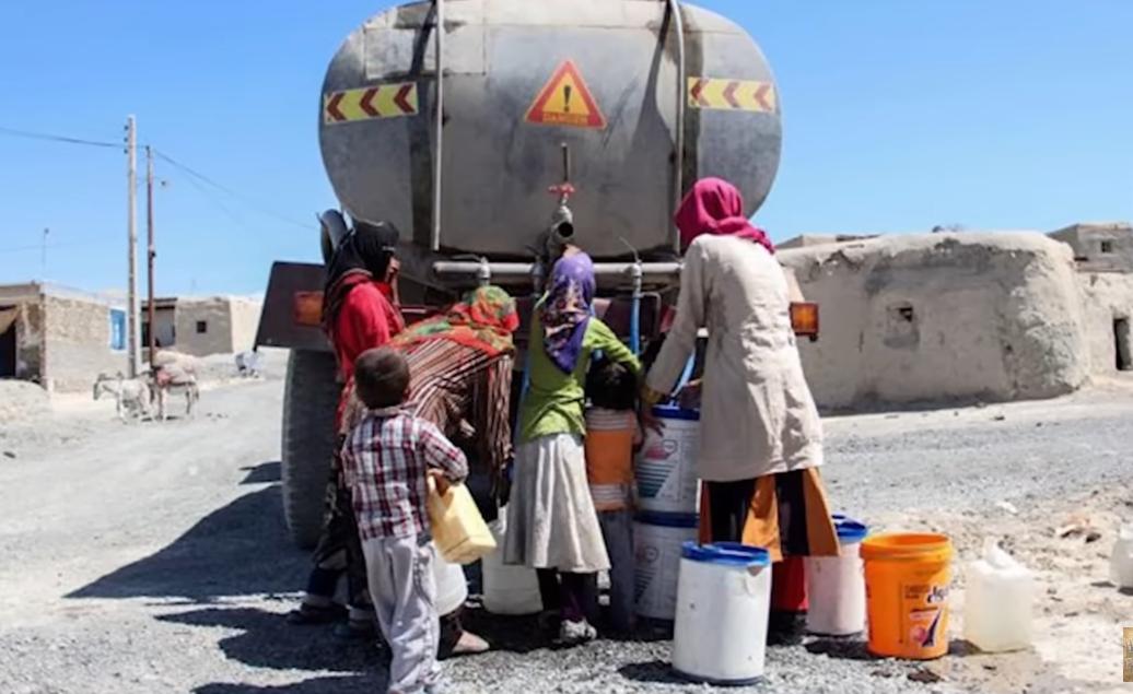
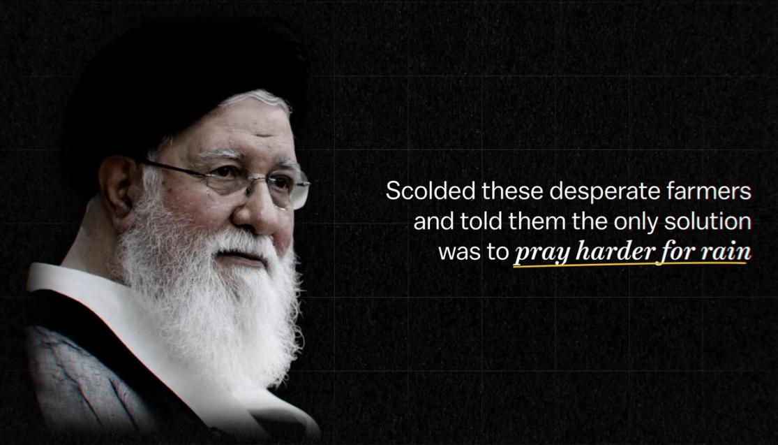
Iran is a rugged country dominated by plateaus and mountains. There are two important mountain ranges, the Elburz Mountains in the north and the Zagros Mountains in the west. The dominant populated areas is the Iranian Plateau which covers much of central and eastern area of Iran. This is the country's heartland and although somewhat arid where most of the country's fertile agricultural land is located. A prominent feature is Dasht-e Kavir, in he north south of the Elburz Mountains is the most desolate area of Iran. It is a sandstone and salty desert plateau. During the summer it is one of the hottest places on the planet. The most important river is the Karun, found in he southwestern corner, but it is a relatively small river. Other rivers arise in Afghanistan, creating a major problem as that country builds dams. Lake Urmia in the extreme northwest is the country's largest body of water, although water levels are falling. The north borders on the Caspian Sea, one of the most endangered bodies of water in the world. Iranian sewage is now one of its major problems. Iran's highest point is Mt. Damavand in the Elburz has an elevation of 18,934 ft (5,771m). The southern coast borders on the Persian Gulf and Gulf of Oran (Arabian Sea). The Persian Gulf basin have an immense oil and gas resource. The Strait of Hormuz dominate the entrance to the oil rich Persian Gulf. Iran not only has a rugged geography, it is a relatively arid country. It has no great rivers, but ancient Persians created a great civilization none the less. The Islamic Republic not so much. The Mullahs in sharp contrast have pursued policies that are destroying the country. Chief among them are Islamic Republic water policies. The Iranian population has increased hugely which the Mullahs see as a positive development. It has, however, greatly increased the demand for water in a arid country. This not only expanded demand for water in urban ares, but also in rural areas where more food had to be grown to feed the expanding population. This was dome by draining natural and nonrenewable aquifers and lakes for urban needs and irrigation. The result is drying up lakes and rivers as well as sink holes. Today Tehran not only is experiencing water shortages, but is quite literally sinking. The other approach was to build dams. Iran has become a country of dams. Only corruption and incredibly poor research and planning has meant that these dams for the most part have worsened the water situation. Today the water problem is reaching crisis levels and Iran may have to move its capital as Tehran becomes unlivable. And rather than use its oil wealth to address the crisis, Iran has used it to kill Jews and destroy Israel--the one country that has developed the technology needed to address the country's growing water crisis. But the Mullahs have a sollution. When farhers in Isfahan protested that the rivers were dryhing up, hard-line cleric Ayatollah Alamolhoda, President Raisis father-in-law, scolded the farmers and told them that the only sollution was to 'pray harder for rain'. As one might expect so far the Ayatollah's sollution has not worked. The other sollution has been to shut down the internet, but that has not worked any better.

Navigate the Boys' Historical Clothing Web Site:
[Return to the Main Iranian page]
[Return to the Main Middle Eastern page]
[Introduction]
[Biographies]
[Chronology]
[Climatology]
[Clothing]
[Disease and Health]
[Economics]
[Geography]
[History]
[Human Nature]
[Law]
[Nationalism]
[Presidents]
[Religion]
[Royalty]
[Science]
[Social Class]
[Royalty]
[Bibliographies]
[Contributions]
[FAQs]
[Glossaries]
[Images]
[Links]
[Registration]
[Tools]
[Boys' Clothing Home]