
European Voyages of Discovery: Iberian Genesis
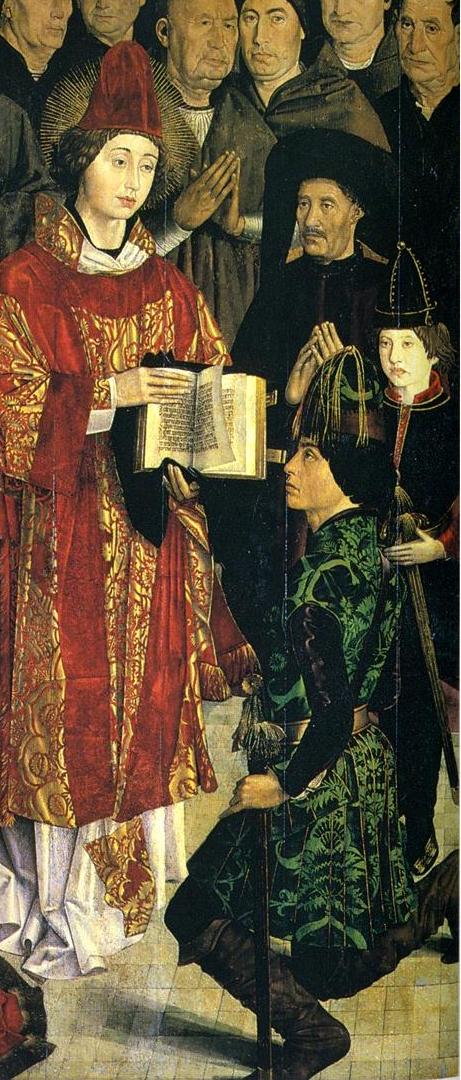
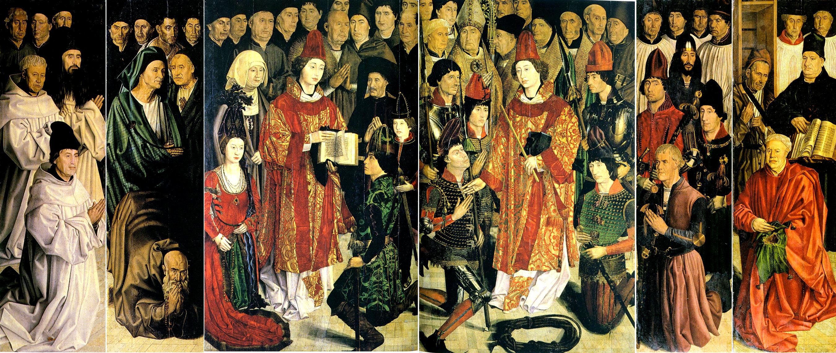
Figure 1.--Primce Henry's Institute at Sagres was built at Cape St. Vicente on the southwestern-most point of Portugal. It was here that the geographic and nautical information was collected upon which the Portuguese voyages of discovery were based. St. Vincent was the the Protomartyr of Spain and venerated throughout Portugal. The famous St. Vicente Panel was painted by Nuno Gonçalve (1450s-60s). In it he depicts Price Hernry along with King Alfonso V and his son and future king, John II. Some believe the individul often seen as Prince Henry was his brother King Edward. These are the men who led Portugal's maritime outreach.
|
|
It is no accident that Portugal and Spain would seek their fortunes at sea and the European maritime expansion. The Iberian Peninsula juts out into the Atlantic Ocean, west toward the Americas and south toward the Cape of Good Hope and the routes to the East. The Portuguese court and Prince Henry the Navigator led the famous European voyages of discovery. It would be the one major intelectual achievement of of Castholic Iberia under the influence of the Inquisition. The voyages of discovery would lead to a monmentous shift in the European balance of power from Eastern to Western Europe and eventually to northern Europe. Two nations led the early explorarions in the 15th century--Spain and Portugal. These two countries pioneered the sea routes that would lead Europeans to Asia and the Americas. Geography is a poweful factor in history. Virtually separated from Europe, Iberia is almost surounded by water and perhaps most importantly, they had the cloest ports to the Americas and sea routes south. Captains like Vasco de Gama and Christopher columbus led the way. They began the creation of global empires and unbelievable wealth. The two countries took two different routes. The Portuguese set about building a tremendous body of geographic and navigational date which led Portuguese seamen to sail south. The Spanish on the otherhand wihout the massive Portuguese geographical data base, secured the services of Italian seamen to conduct voyages and sailed west.
The accumulating knowledge of geopgraphy and improvements in shipbuilding and navoigation led Prince Henry and King John II of Portugal to seek a route to the Indies through the still largely unknown Atlantic. Portuguese mariners began sailing south along the coast of Africa. Information provided by travelers was refined by explorers who began to sail south along the African coast. Each voyage added to the accumulating data and gradually improving maps and charts. The Portuguese eventually reached the equator (1471). One unaswered question of history is just how much Portuguese navigators knew. Some historians argue that it was the Portuguese who first discovered the America, landing in Brazil. Even a cursory study of the may suggests that Portuguese saemen sailing south must have stumbled on the buldge of Brazil where it juts out ibnto the South Atlantic. Unfortunately we will never know as the famed Portuguese archive was lost to fire. We do know, of course, that Bartholomeu Dias reached the Cape of Good Hope at the southern tip of Africa (1486), showing that Ptolemy was wrong about the possibility of a sea route to Asia. Vasco da Gama reached India (1498). Portugal was thus the first European nation to reach India, the Indies, and China. Soon after Columbus first reached Ameruica, Pedro Alvares Cabral (1467-1520) discovered Brazil (1500). Gaspar Corte Real sailed to North America and although he founded no colony helped to found a flourishing fishery. Ferdinand Magellan (1480?-1521) served in the forces of the Portugese crown involved in military campaigns in India and the Spice Islands (1508-12). Magellan conceived of reaching the Spice Islands (Indonesia) via the Atlantic, but King Emanuel was uninterested, causing Magellan to renounce his Portuguese citizenship.
The marriage of Ferdinand V of Castile and Isabella I of Aragon essentially united the Iberaian peninsula, except Portugal, into a Spanish monarchy (1479). The last Moorish city, Granada fell (1492). With the Moors at last defeated, the Spanish could turn their energies into naval expansion, but were behind the Portuguese in this area. Genonese navigator Christopher Columbus is the most renowned of all the great explorers. He sailed west under the banner of their most Cathlolic magesties Ferdinand and Isabella, hoping to reach the Indies (1492). The voyage was intensely debated by Spanish authorities. Knowledgeable people did not believe that the world was flat. Many did believe that the world was so large that the crews of ships sailing west would perish before reaching Asia. Columbus of course found America, although it was not until his third voyage that he began to realize that he had found an entire new continent. Nuñez de Balboa reached the Pacific over the Istmus of Panama (1513). Charles I commissioned Magellan to find a passage through the Americas to the Spice Islands. Magellan sailed from Seville (1519) and explored the Plate estuary (1520) before crossing into the Pacific through the straits at the tip of South America now named for him. He claimed the Philippines for Spain, but was killed there (1521). One if his ships managed to return to Seville, completing the first circimnavigatiin of the world (1522). Conquistadores Hernado Cortes and Francisco Pizarro conquered the Aztec and Incan civilizations, laying claim to great wealth and a vast colonial empire for Spain. Although at first disappointed with their new lands, the conquest of the Aztecs and Incas brought vast quantities of gold and silver flooding into Spain and through Spain the rest of Europe and had an enormous impact on the still largely feudal European economies. Many other new products were brought back to Spain. One of these, the humble potato, had an even more profound impact than the gold and silver. Coronado and Ponce de León expanded the Spanish claim to North America as well.
Treaty of Tordesillas (1494)
Columbus' voyage and claims created the possibility of conflict and war between Spain and Portugal (1492). The initial Portuguese concern was to protect their monopoly on the trade routes they had developed to the East around Africa. Only as the dimensuions of Columbus' discoveries began to emerge that land boundaries became an important issue. Some hiostorians speculate that the Portuguese had discovered Brazil before Columbis' voyage, but was keeping it secret. The issues involved with territory and trade threatened to break the already tenuous peace between the Iberian monarchs, Spains Ferdinand and Isabella ans Portugal's King João II. Portugal had led the maritime outreach, but Spain was a muvh lsrger country and coveted the riches being returned to Portugal. Pope Alexander VI, the notorious Rodrigo Norgia, stepped in to maintain the peace. The Pope's answer was a bull "Inter cetera divina" dividing the world known and unknown between the two countries (1493). The pope drew an imaginary line running north and south through the mid-Atlantic, 100 leagues (480 km) from the Cape Verde islands. Spain could claim land to the west and Portugal to the east. The Portuguese began to realize that the pope's line gave Spain the entire New World. They insisted on renegotiating the line with Spain. The result was the Treaty of Tordesillas (1494). The Treaty established a new line 370 leagues (1,770 km) west of the Cape Verde Islands. This still left most of the New World to the Spanish, but as the geography of the New World was still largely unknow, this was not yet apparent. One historian writes, "With the stroke of a pen, [Pope Alexandr VI] created an imaginary line diviing the world .... Spain and Portugal affirmed the papal decrees of the Inter Caetera in the treary signed in the Spanish town of Tordesillas in June 1494. But they moved the line of demrcationbetween the Spanish and Portuguese zones of influence several hundred kilometers further wst. This placed an as-yet to be discovered Brazil in the Portuguese half of the world, as well as protected Portugal's African trade routefrom any European competition. The world was now officially divided." [Bown] The Portuguese who settled in Brzail gradually moved west over the line, but because this was into areas of little importance to the Spanish, there was little conflict. The historical impact, however, is that inspite of the Treaty, Brazil today represents half of the South American continent.
CIH

Navigate the Children in History Website:
[Return to the Main Voyages of Discovery page]
[Return to the Main 15th century page]
[Return to the Main 16th century page]
[Return to the Main European history pager]
[Introduction]
[Biographies]
[Chronology]
[Climatology]
[Clothing]
[Disease and Health]
[Economics]
[Geography]
[History]
[Human Nature]
[Law]
[Nationalism]
[Presidents]
[Religion]
[Royalty]
[Science]
[Social Class]
[Bibliographies]
[Contributions]
[FAQs]
[Glossaries]
[Images]
[Links]
[Registration]
[Tools]
[Children in History Home]
Created: 2:15 AM 1/28/2019
Last updated: 2:15 AM 1/28/2019